Real Time Flood Simulator
Safeguarding lives and vital infrastructure from the risk of flooding is crucial. Our mission is to empower resilience and adaptation to flood disasters. With data-driven insights, real-time monitoring, and strategic planning, our solution paves the way for a safer, more resilient future.
Whether for government agencies or private enterprises, DioVISTA/Flood provides robust tools for building effective flood damage countermeasures.
Using Hitachi’s original fast calculating method (Dynamic DDM*)
Non-experts can easily execute advanced simulations
From rainfall to flooding, DioVISTA/Flood automatically build necessary models from map data

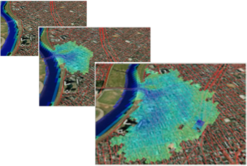
Forecast the extent of flooding in specific areas
Forecast the water level at any specific location
Perform simulation based on historical flood data
Model various flood scenarios to understand potential impacts
Disaster prevention center
Da Nang City & Binh Dinh Province, Vietnam
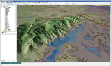
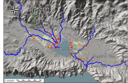
DioVISTA assisted staff in creating a 2D flood hazard map for Da Nang City and a 3D map for Binh Dinh Province. The accuracy of these maps was validated by comparing them to historical flood level data.
Ministry of Economy, Trade, and Industry
Gorontalo, Indonesia
We conduct flood simulation around Limboto Lake with DioVISTA using data provided by the locals and open data. We validated the simulation result quality by comparing to historical data from several sites.
Convenient way to lease for a low upfront cost.
Tailored services, comprehensive solutions for larger organization.
Contact us to discuss about details regarding your needs
DioVISTA/Flood is a real-time flood simulator integrated with GUI (Graphical User Interface), enabling users to conduct flood simulations with ease. You can download the free version from this link and start your simulation by following the instructions provided here.
DioVISTA/Flood offers a subscription plan tailored for both professional and academic users. The monthly subscription for professional users is priced at $2,499, whereas academic users can access the plan for $2,499 annually.
DioVISTA/Flood is a simulation tool designed to model and analyze flood scenarios, while DioVISTA/Storm serves as a 3D viewer for rainfall radar data over online maps, and DioVISTA/Dam supports advanced dam management for flood control and optimizing hydropower generation.
DioVISTA/Flood is compatible with various other products. Reach out to us if you would like to have a discussion about this.
| Item | Minimum configuration | Recommended configuration |
|---|---|---|
| CPU | 1 GHz or faster 64-bit compatible processor with 2 or more cores | Intel® Core™ i-7 processor (13th generation or later) |
| Memory | 4GB | 16GB |
| Graphics Accelerator | 3D graphics accelerator (memory 1024 × 768 × 32 bit) | NVIDIA® GeForce® RTX40 series or later, or Intel® Iris® XE Graphics series or later, or equivalent |
| SSD | 100 GB space | 2 TB |
| Screen Resolution | 1,024 × 768 dot 16,770,000 color (24-bit True Color) | 1,920 × 1,080 dots 16,770,000 color (24-bit True Color) |
| OS | Windows® 10 (English version) 64-bit version or Windows® 11 (English version) | |
| USB Terminal | Port (1 port) for license authentication USB key (USB protected chip) connection. | |
| Port (1 port) for portable SSD (storing program) connection. | Port (1 port, USB 3.0 recommended) for portable SSD (storing program) connection. | |
| Mouse, etc. | Mouse or touchpad | Mouse with Wheel |
| Two-factor authentication | A mobile device with an internet connection and the Microsoft Authenticator app installed | |
DioVISTA/Floodsimulation
Prepare for the unexpected Flood Risk Analysis Service